The National Oceanic and Atmospheric Association is a notable weather service we use to determine the weather outlook for the next few days. Due to the significant elevation changes of the area it is necessary to use a specific location for weather conditions. The following are links to key locations on and surrounding the Aquarius Plateau and in and surrounding the Canyons of the Escalante River.
Hiking in the canyons and exposed areas of the desert benches as well as on Boulder Mountain poses significant risks from lightening, flash floods, cold exposure (even in the middle of summer) and heat exposure. The weather changes very quickly in this area and approaching weather is frequently not visible. If you are not familiar with local weather pattens and weather related safety procedures, please take time to learn such or travel with someone who is familiar with these patterns and safety procedures. Please take proper precautions when hiking in this area.

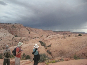
Beautiful skies just a half hour earlier turned to potential flash flood weather that dictated staying out of slot canyons. We received not a drop of rain, BUT YOU NEVER KNOW!!!
The following links take you to the NOAA website site for the particular location.
Towns
Aquarius Plateau
Canyons of the Escalante River
Escalante River Trailhead at Highway 12
Escalante River Trailhead at Escalante Town

